
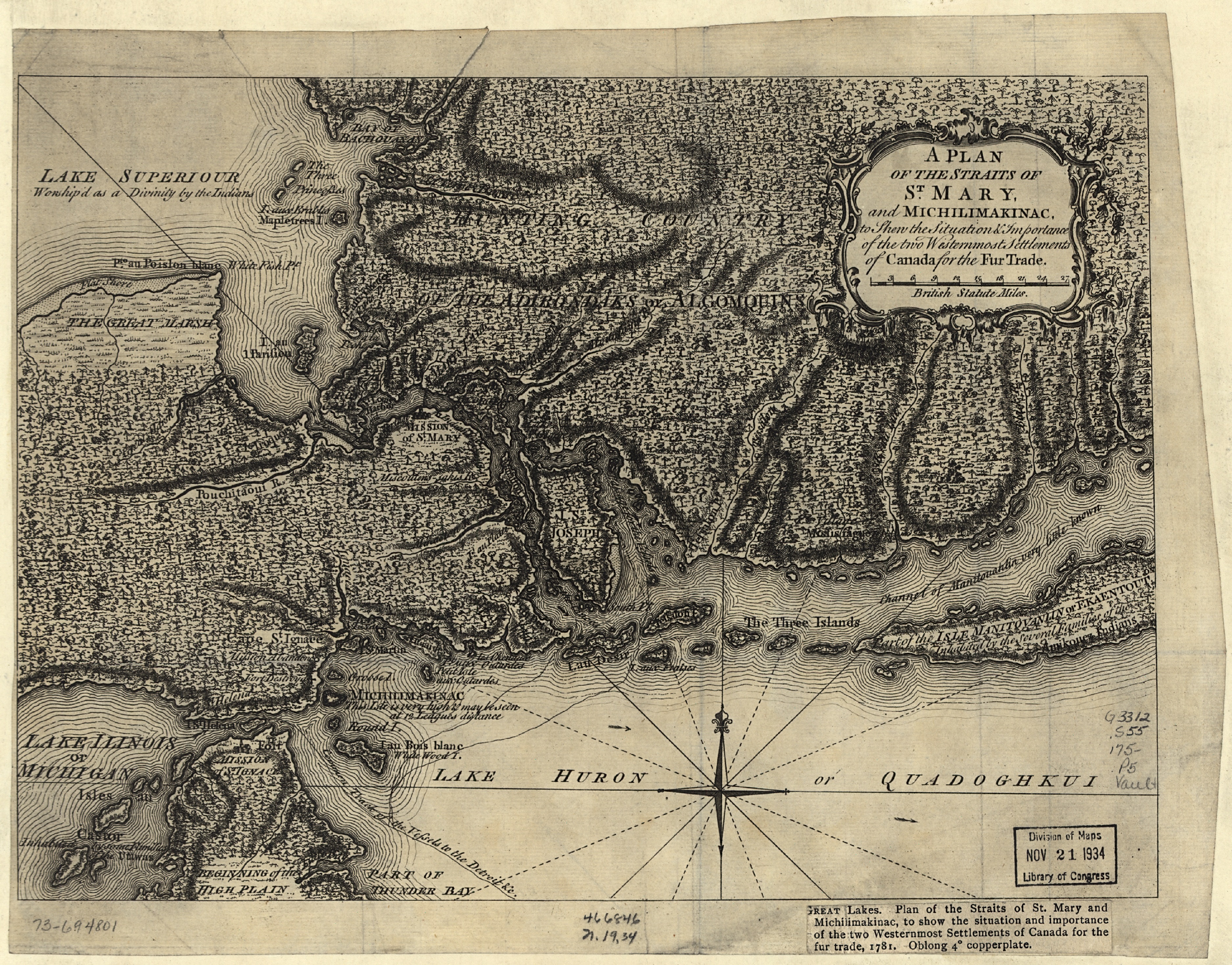
A Plan of the Straits of St. Mary, and Michilimakinac, to shew the situation & importance of the two westernmost settlements of Canada for the fur trade
Description:
Scale ca. 1:75,000.
LC copy has printed title with incorrect date [i.e. 1781] glued in lower right margin.
LC Maps of North America, 1750-1789, 770
Available also through the Library of Congress Web site as a raster image.
Vault
AACR2