
Etats-Unis: Partie Setentrionale
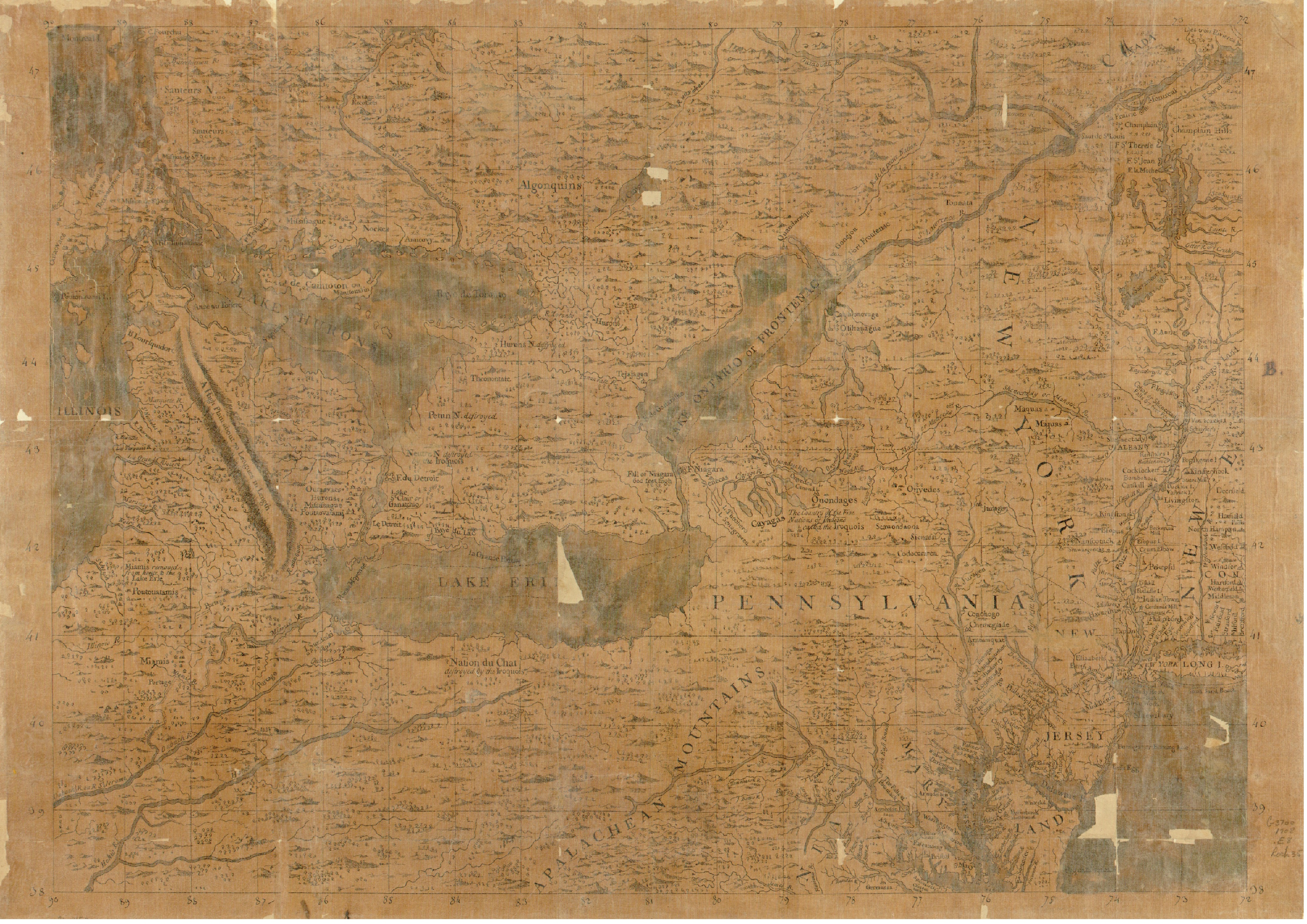
"This manuscript map, in pen-and-ink and watercolor, dating from 1708 mainly shows the English colonies of Pennsylvania and New York as their geography was understood at that time. It encompasses the region stretching from Lake Michigan (Lake Illinois on this map) to the west, Ontario and Quebec to the north, western New England to the east, and Virginia and the southern Appalachian Mountains to the south. The map identifies the territories inhabited by many different Indian tribes and provides historical information about tribal conflicts and population transfers. It also shows lakes and rivers, sometimes offering both English and French names, as well as hills, mountains, waterfalls, offshore islands, and other geographical points of interest. Prominent bodies of water shown include Chesapeake Bay; the Potomac, Susquehanna, Delaware, Hudson, and Saint Lawrence rivers; and Lakes Superior, Michigan (Illinois), Huron, Erie, and Ontario (Frontenac). The map indicates many towns and cities in what later became the northeastern United States, including Philadelphia, New York, Albany, and numerous smaller nearby communities. Relief is shown both pictorially and by hachures. The map has watermarks and several holes and tears, especially along the folds and creases. The anachronistic title is from a manuscript label on the verso as it was originally mounted. The map is from the Rochambeau Collection at the Library of Congress, which consists of 40 manuscript maps, 26 printed maps, and a manuscript atlas that belonged to Jean-Baptiste-Donatien de Vimeur, comte de Rochambeau (1725-1807), commander in chief of the French expeditionary army (1780-82) during the American Revolution. Some of the maps were used by Rochambeau during the war. Dating from 1717 to 1795, the maps cover much of eastern North America, from Newfoundland and Labrador in the north to Haiti in the south. The collection includes maps of cities, maps showing Revolutionary War battles and military campaigns, and early state maps from the 1790s." World Digital Library.